
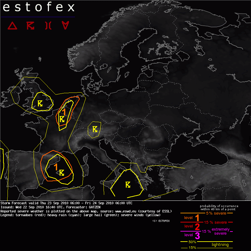
North-eastern Spain
Rich boundary-layer moisture (13 g/kg) is present over the Mediterranean Sea and will spread into north-eastern Spain ahead of a surface low approaching over southern Spain. Low-level convergence and upslope flow are likely during the day, and diurnal heating will help to build CAPE. Additionally, upward vertical motion is expected from the morning on east of the approaching trough. Especially in the afternoon hours, when an intense mid-level jet streak will spread into eastern Spain, strong DCVA is forecast over north-eastern Spain.
Initiation of storms is expected in the noon or afternoon hours. With strong deep layer vertical wind shear (about 20 m/s in the lowest 6 km), storms are forecast to organize and pose a threat of large hail and severe wind gusts. These storms will likely merge into mesoscale convective systems as the QG forcing will be strong and a persistent and concentrated low-level convergence is expected. Excessive rain seems to be the main threat after sunset that will gradually shift to the Balearic Islands during the night hours.
Una situación así merece un esfuerzo en la traducción.

NE de España.
Abundante humedad del estrato fronterizo (13 g / kg) está presente en el Mar Mediterráneo y se extenderá hasta el NE de España por delante de una baja superficial que se acercará por el sur de España. La convergencia en capas bajas y el viento anabático es probable durante el día, y el calentamiento diurno ayudará a construir CAPE. Además, se espera movimiento vertical ascendente desde la mañana al E de la vaguada que se aproxima. Sobre todo por la tarde, cuando el golpe del chorro en niveles medios se extienda hacia el este de España, se pronostica fuerte DCVA (Advección diferencial de vorticidad ciclónica) en el NE de España.
La iniciación de las tormentas se espera para el mediodía o las horas de la tarde. Con la fuerte cizalladura vertical del viento (unos 20 m / s en los 6 kms más bajos), las tormentas tenderán a organizarse y representará una amenaza las fuertes granizadas y ráfagas de viento fuerte. Estas tormentas probablemente se integrará en sistemas convectivos de mesoescala como el forzamiento cuasi geostrófico será fuerte, y se espera convergencia persistente y concentrado en capas bajas. La lluvia torrencial parece ser la principal amenaza después de la puesta del sol que poco a poco se desplazará a las Islas Baleares durante las horas de la noche.


